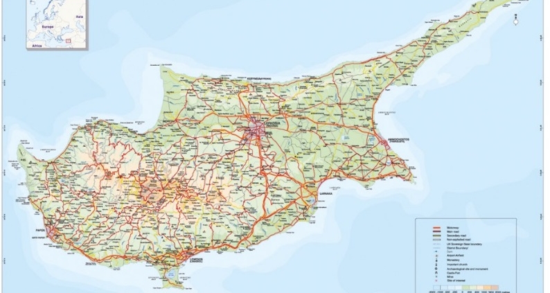
A Cyprus road map is one of the most useful tools for visitors exploring the island by car. Cyprus offers an extensive road network connecting major cities, mountain villages, coastal resorts, archaeological sites and nature trails.
Whether you are planning a road trip in Troodos Mountains, visiting beaches, or exploring traditional villages in the districts, having an updated Cyprus road map helps travelers navigate efficiently and discover new destinations.
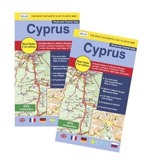
SELAS has been producing detailed maps of Cyprus for more than 30 years, combining geographic accuracy with practical travel information for residents, tourists, schools and professionals.
Main Road Network in Cyprus
Cyprus has a modern highway system connecting:
- Nicosia
- Limassol
- Larnaka
- Pafos
- Agia Napa -Paralimni
The main motorways include:
- A1: Nicosia–Limassol
- A2: Nicosia–Larnaka
- A3: Larnaka–Agia Napa
- A6: Limassol–Pafos
Mountain roads in the Troodos region are scenic but may include sharp turns and steep slopes, especially during winter months.
Tourist Destinations commonly found on Cyprus Road Maps
A detailed Cyprus road map typically includes:
- beaches
- villages
- monasteries
- archaeological sites
- picnic areas
- nature trails
- mountain resorts
Popular driving destinations include:
- Troodos Mountains
- Akamas Peninsula
- Cape Greko
- Kykkos Monastery
- Cedar Valley
- Avakas Gorge
- Kalidonia Falls
- etc
Preview the Cyprus Road Map

The SELAS Cyprus Road Map includes detailed road networks, villages, tourist attractions, mountain routes and district information designed for travelers, educators and researchers.
Explore Map Features
- Highways, main and secondary roads
- Villages and municipalities
- Tourist attractions
- Scenic mountain routes
- Distance indicators
- Major landmarks
Discover detailed road networks, villages, natural landmarks and tourist destinations across Cyprus.
Related Products
Pocket Road Map of Cyprus (in English)
Road & Tourist Map of Pafos (Town & District) (in English)
Cyprus Physical Wall Map (in English)
3D Relief Wall Map of Cyprus (in Greek)
FAQ Section
What is the best scale for an easy-to-use road map of Cyprus?
A scale of 1:250,000 provides a clear overview of Cyprus road networks, villages, and major landmarks, making it ideal for travel planning and general navigation.
Is the relief depicted on the map?
Yes. Relief is shown using hypsometric tints, allowing users to easily distinguish between plains, hills, and mountainous areas.
Is the Cyprus road map suitable for tourists?
Yes, it is designed for both residents and tourists, showing major highways, scenic routes, and key destinations across the island.
Does the map include villages?
Yes. All villages of Cyprus are included on the map, including abandoned or uninhabited settlements where applicable.
Can the map be used for educational purposes?
Yes, it is widely used in schools and educational contexts for teaching geography and spatial understanding of Cyprus.
