GIS Services
Leading Provider of Geographical Data
to European and Global Markets
SELAS has a long experience in the implementation of GIS projects and has been assigned a variety of GIS projects for medium and large sized public and private companies and organizations that cover a wide range of industries (navigation, retail, municipalities, e-commerce, telecommunications, logistics, etc.).
Our experts in GIS can provide independent consultancy services to any organization seeking to exploit the GIS technology. Geographical Information Systems (GIS) can analyze special data and visualize it in the form of maps and reports.
SELAS provides GIS Services to both the public and private sectors which include:
SELAS is proud to have created the most comprehensive geodatabase of Cyprus which enables us to provide geographical data to European and Global markets and leading international navigation companies.
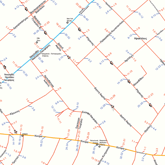
The rich digital geographical database of Cyprus “MapCyprusTM” produced during our 33 years of existence, allow us to offer GIS data of Cyprus of large scale and high resolution, in any projection system and fully compatible with the most widespread GIS software.
SELAS produced its Geographical Data using state-of-the-art technology, photogrammetric and other methods. GIS data is continuously revised and subject to high quality controls. It is today Cyprus’ most up-to-date navigable road network database of scale 1:5.000-1:10.000. Navigable is the road network that feature the streets and interconnections connectivity and includes data such as the road category, street name, street numbering, direction, speed etc.
SELAS has developed and maintains a specific SW tool for GIS data administration. GIS data is updated on a daily basis using technologically advanced equipment from a variety of controlled sources.
The geographical database, which is fully navigational in GPS devices allows the creation of interactive digital applications based on the client’s requirements. The know-how of our company gives a competitive advantage to undertake major projects in Cyprus and abroad. GIS data can be also offered in a form of “Map Services”.
SELAS Geographical data consists of:

Rivers, Streams, Lakes, Salt Lakes.
Points of Interest: Provide valuable information for companies and various organizations seeking data visualization/spatial analysis for decision making. This permits studying and analyzing market trends, understand competition or discovering development opportunities.
The Points of Interest could be useful to a large number of companies such as retail, telecommunications, navigation companies, municipalities, health etc.
Sample of MapCyprusTM database of points of interest is presented below:


Geoprocessing services are developed to manage geographical data. The services accept a request, process it with the help of geographical information and produce a result.
Geoprocessing Services provide answers and solutions to a wide range of questions such as:
The above questions can be answered by the following services:
We have developed software service-modules for each of the above services and have them available through the Internet. We are using the service modules as building blocks for every new application that requires these types of functionality.
Where is the address located in the map? Which is a corresponding address to a pair of XY or Longitude-Latitude coordinates?
Geocoding is the process of associating geographical elements such as addresses or points of interest to map coordinates.
Reverse Geocoding is the process of associating map coordinates to geographical elements.
Address Normalization is the process of identifying and correcting an address according to generally accepted standards. During address normalization, an address brakes down to at least the following elements: street name, street number, postal code, municipality.
Sample of MapCyprusTM database of addresses is presented below:

The service locates on the map the address or the POI of interest. The search machine is using the “free text algorithm” which accepts as an input a string as a free text such as “banks in Nicosia”, part of a string “hotel”, in incomplete format “Makariou 5 Street”, even with spelling errors and/or Latin characters.
The routing service allows the selection of transportation means (car, mass transportation or pedestrian), the selection of the best route (by time or distance) or using a combination of parameters (first and last point retention, pedestrian or car use).

This geo-processing service is used for the calculation of the geographical area that a vehicle can cover from the start point in predetermined time period, for example 5-minute drive. The service area appears as a polygon on the map.
For example, the 8-minute point service area includes all streets which are less than or equal to eight minutes time distance from a starting point. This service is useful to a large number of companies which need to determine their store service areas, such as delivery restaurants, or supermarkets who need to have statistic figures of their clientele around their stores, etc.
It is important to note that the result of the services does not necessarily have to be displayed on a map, it may be a number or a text. For example, you can get your customers’ locations within 10 minutes of your store, or the time in km and minutes needed to deliver to a specific area etc.

Demographic data for the polygon such as percentage of covered population, age pyramids etc. are available to the user.
This allows to minimize the operating routes’ costs of a fleet by calculating the minimum delivery time or the minimum distance traveled such as organizing the number of orders delivered from a Company’s premises to its customers from a particular fleet of vehicles and drivers. This helps Companies to save time and money and increases their productivity.
This service allows you to find the distance between facilities and emergency events. For example, if a fire occurs in a specific location, you can get be informed which fire station is closest to the point of the fire in distance and time to get there as well directions to get there.
This service concerns facilities providing goods or services and a number of demand points. The location-allocation informs on the location of the number of facilities which can serve specific demand points in the most efficient way. Example of location-allocation service is the distribution of stores in supply depots which can serve the largest geographic area in the shortest possible time.
The service shows live information on the map such as pharmacies on duty, current prices of products or services which can be changed on a daily basis, cultural events, or any other event that has a specific duration.
All your applications can be displayed on the most detailed and up-to-date cartographic background of Cyprus produced by SELAS.
Geo-processing services are the building blocks for the creation of apps. We offer all the above services to develop apps to meet your own exclusive needs.
All the above geo-processing services are offered in the form of Api’s in the following ways:
We can also offer geographical data and GIS software, as well as consultancy and training in order to create your own services.
What is the benefit of Geo-Processing Services?
Using our geo-processing services the companies benefit from the followings:
Our long experience in the implementation of GIS projects allows us to offer business solutions for data visualization and spatial analysis for decision making for any company’s needs as well as creating special Webmaps.
Such Webmaps could show the visualization of the company’s stores, its clients, the stores of the competitors, the revenues per store, per month or year etc.
We have a wide range of clients in the retail, logistics, real estate sectors etc. to whom we offer custom mapping for their special needs.

Postcode maps are an essential tool for businesses for analyzing and visualizing their data, plan their itineraries and manage their fleet, for the distribution of their goods and services, for organizing the distribution of their advertising material, for depicting demographic data, for statistical analysis and for any other special need.
Postcode maps can be prepared for any region, city, province or the entire island, in any scale, size and format (printed or digital).
Depending on the needs of each company, the postal code maps, may include polygons of municipalities and communities with or without names, polygons with postcodes numbers per municipality/community, the main road network and any other data.

Our highly qualified experts are able to provide independent consultancy services to any organization seeking to exploit the GIS technology.
We offer consulting services in the following areas:
GIS Project management: Following the PMI standards and techniques. Our team investigates and evaluates all factors that affect the success of the project such as the clarity of the project purpose and deliverables, the team selection, the involved parties, the project’s risks and realistic scheduling by constantly evaluating the progress of the project and the convergence to the results.
Geospatial Database Design: Geodatabase design constitutes the core of the GIS system. The correct geodatabase design enhances the project’s efficiency in terms of speed and performance.
GIS and corporate Business Intelligence databases are fully interconnected and utilized for the achievement of the best possible result. SELAS can provide the GIS databases as Web Map Services or as ESRI open data.
SW & HW Integration: We are using and recommend ArcGIS, the world’s leading GIS software. ArcGIS operates in stand-alone, web and mobile environments and devices. ArcGIS architecture and interoperability, with a variety of HW implementations, makes it the appropriate development tool for all kinds of industries and for any size of GIS systems. We can analyze the organization SW & HW and propose the best possible interconnection.
Maintenance & Support: Maintenance and support services can include training and support programs and a help desk, software and hardware upgrades, system configuration and implementation of extensions to meet the needs of the client.
Newsletter
Subscribe to our newsletter
![]()
