Description
This unique 3D Relief Map of Cyprus brings geography to life with stunning detail and depth.
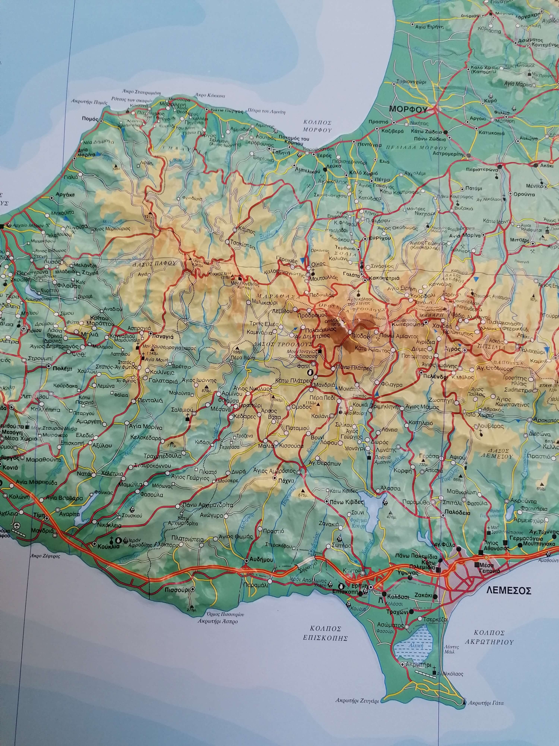
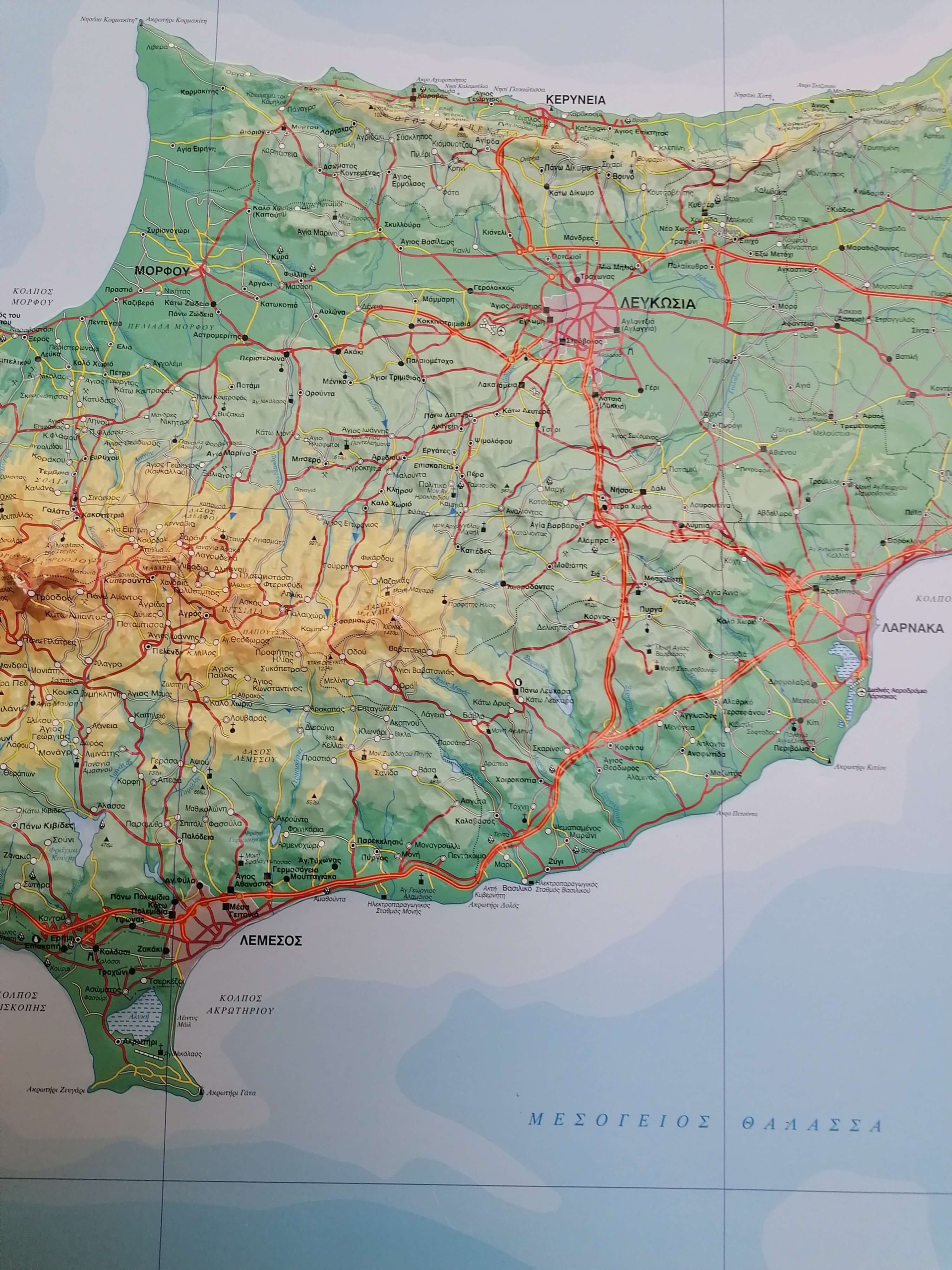
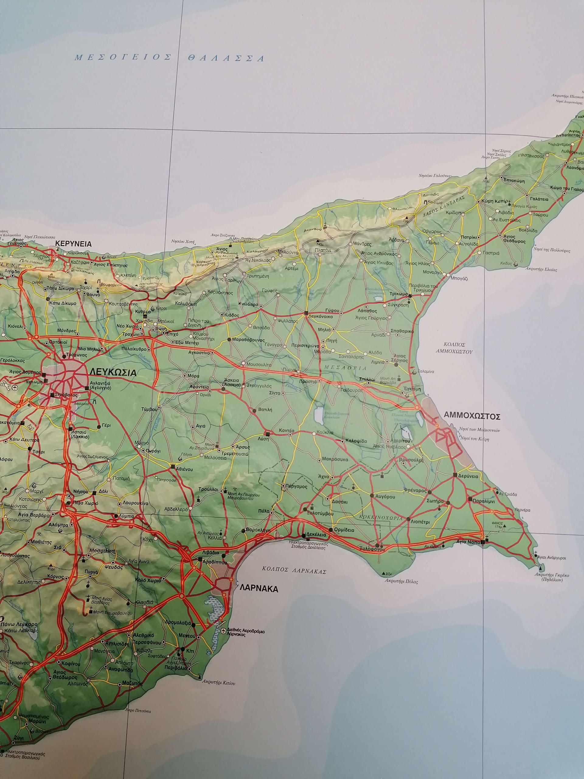
The map accurately represents Cyprus’ terrain using hypsometric colour shading and elevation data, clearly showing plains, mountain ranges, valleys, peaks, rivers, lakes, and dams.
It also includes a detailed road network classified by importance, including paved and unpaved roads, as well as all settlements categorized by population.
Important cultural and historical landmarks are marked, such as monasteries, churches, archaeological sites, and other points of interest.
Produced by the experienced SELAS team of geographers and cartographers, this high-quality map meets strict cartographic standards and is officially approved by the Ministry of Education and Culture of Cyprus.
Beyond its educational value, this 3D relief map is also a unique decorative piece, perfect for homes, offices, schools, and academic spaces. It is also an excellent gift for anyone interested in geography and Cyprus.