World day to combat desertification and drought: using GIS and earth observation to build resilient landscapes
Every year on 17 June, the international community marks the World Day to combat desertification and drought, raising awareness of one of the most pressing environmental challenges of our time: land degradation.
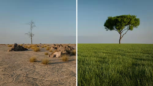
Desertification is often associated with expanding deserts, but in reality it refers to the degradation of land in dry and semi-arid regions caused by a combination of climatic factors and human activities. The consequences are significant, affecting agricultural productivity, biodiversity, water resources, food security, and the livelihoods of local communities.
For mediterranean countries such as Cyprus, where water scarcity and prolonged periods of drought are recurring challenges, sustainable land management is becoming increasingly important. As climate change intensifies, the need for reliable information and evidence-based decision-making is greater than ever.
Monitoring change from Space
Geospatial technologies have become essential tools in understanding and addressing land degradation. Through earth observation data and satellite imagery, it is possible to monitor environmental changes over time, identify areas at risk, and evaluate the effectiveness of mitigation measures.
Remote sensing enables the systematic observation of vegetation health, soil conditions, water availability, and land cover changes across large geographic areas. These datasets provide valuable insights that would be difficult, costly, or time-consuming to obtain through field surveys alone.
The Power of GIS
Geographic Information Systems (GIS) allow environmental data from multiple sources to be integrated, analysed, and visualised in meaningful ways. By combining satellite observations with climatic, hydrological, agricultural, and socio-economic information, GIS supports a deeper understanding of the factors contributing to land degradation.
Such analyses help governments, researchers, environmental organisations, and land managers to:
- Identify vulnerable areas and emerging trends
- Monitor drought conditions and vegetation stress
- Assess land-use changes over time
- Support sustainable agricultural practices
- Plan conservation and restoration initiatives
- Develop evidence-based environmental policies
Supporting Sustainable Development
The fight against desertification is closely linked to several global sustainability objectives, including climate action, biodiversity protection, food security, and the sustainable management of natural resources.
Geospatial technologies provide the tools needed to measure progress, monitor environmental indicators, and support informed decision-making at local, national, and regional levels. As environmental challenges become increasingly complex, access to accurate spatial information will continue to play a critical role in building resilience and promoting sustainable development.
Why This Matters for Cyprus
Cyprus is among the mediterranean countries most vulnerable to the impacts of drought, water scarcity, and land degradation. Rising temperatures, prolonged dry periods, increasing pressure on natural resources, and changing land-use patterns create significant challenges for the sustainable management of the island’s landscapes.
Although Cyprus is not facing desertification on the scale observed in some arid regions of the world, certain areas remain susceptible to soil degradation, erosion and reduced agricultural productivity. These challenges highlight the importance of continuous environmental monitoring and informed planning.
Geospatial technologies can provide valuable support in identifying vulnerable areas, assessing environmental change, and helping public authorities, researchers, and land managers develop effective strategies for sustainable land management.
Looking Ahead
On this World Day to combat desertification and drought, we recognise the importance of protecting our land resources for future generations. Understanding how landscapes change over time is the first step towards managing them more sustainably.
At SELAS, we believe that geospatial information is more than maps and data; it is a foundation for informed decisions, environmental stewardship, and sustainable development. By combining GIS, earth observation, spatial analytics and decision-support tools, we help create a better understanding of environmental challenges and contribute to more sustainable and resilient landscapes.
