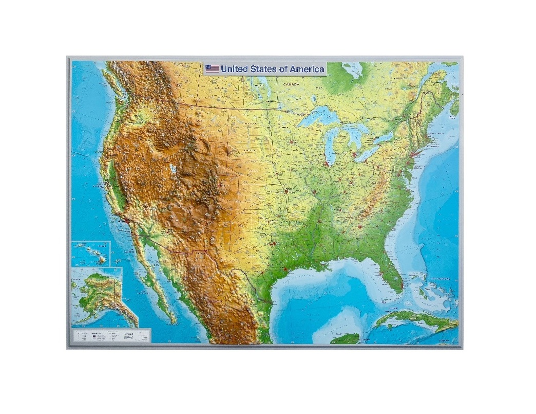
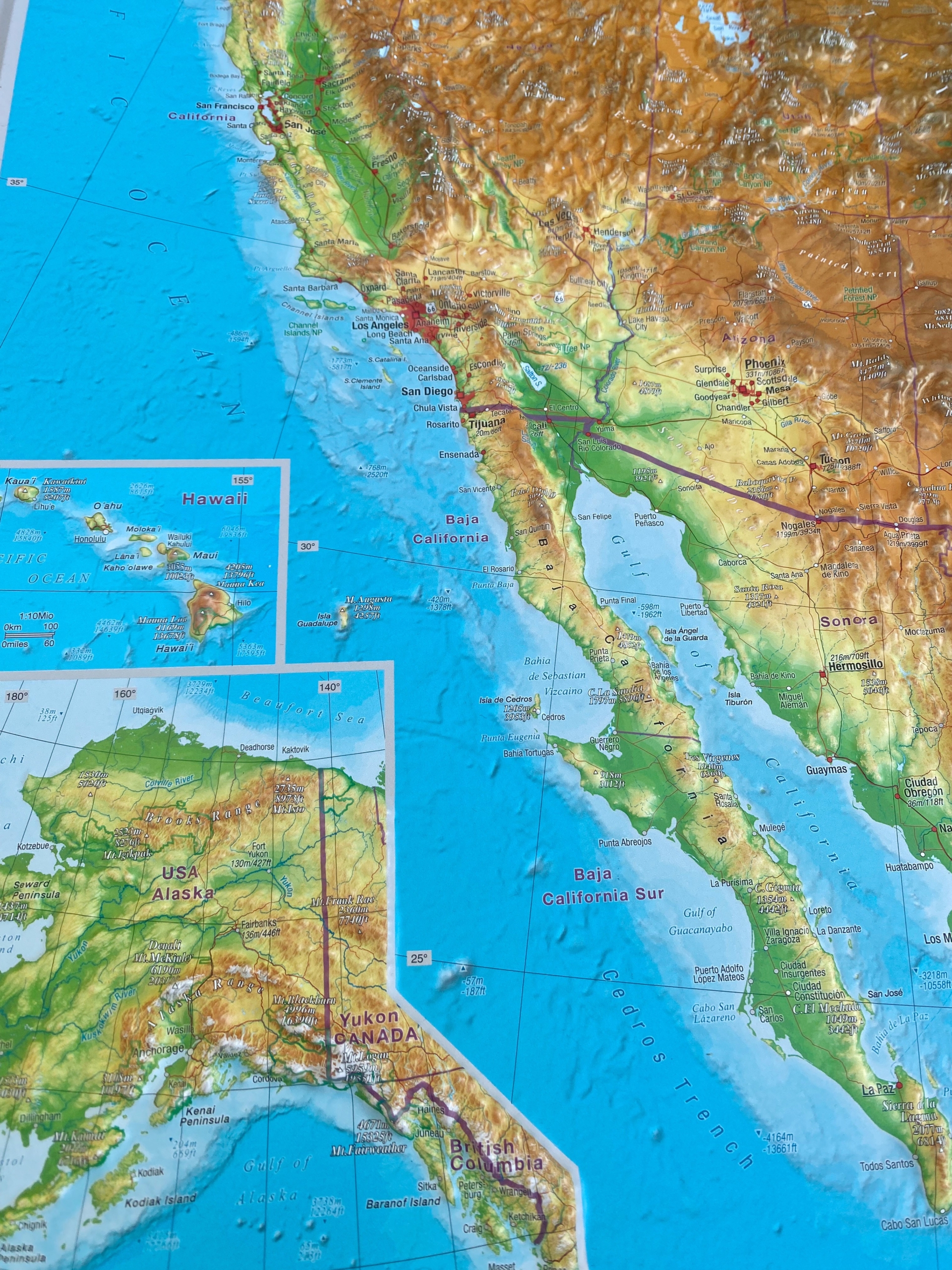
Description
The 3D relief Map of the United States of America is an innovative cartographic product produced in English and developed in accordance with the highest international cartographic standards.
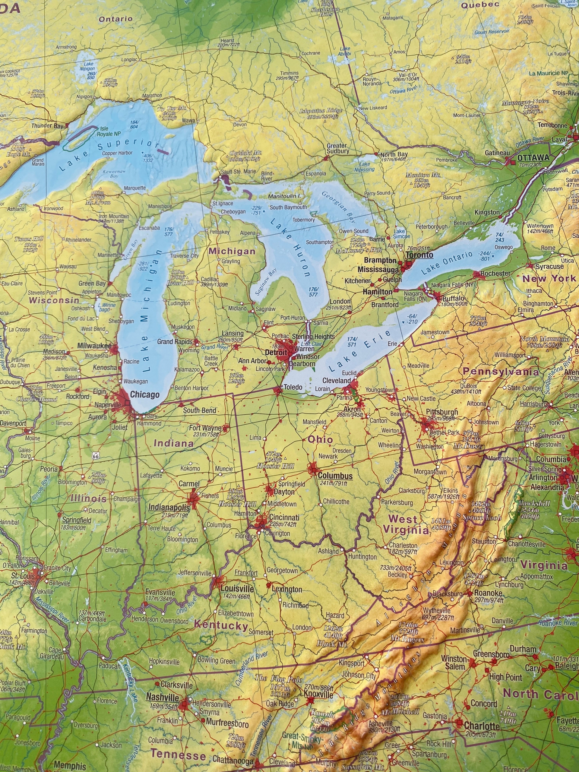
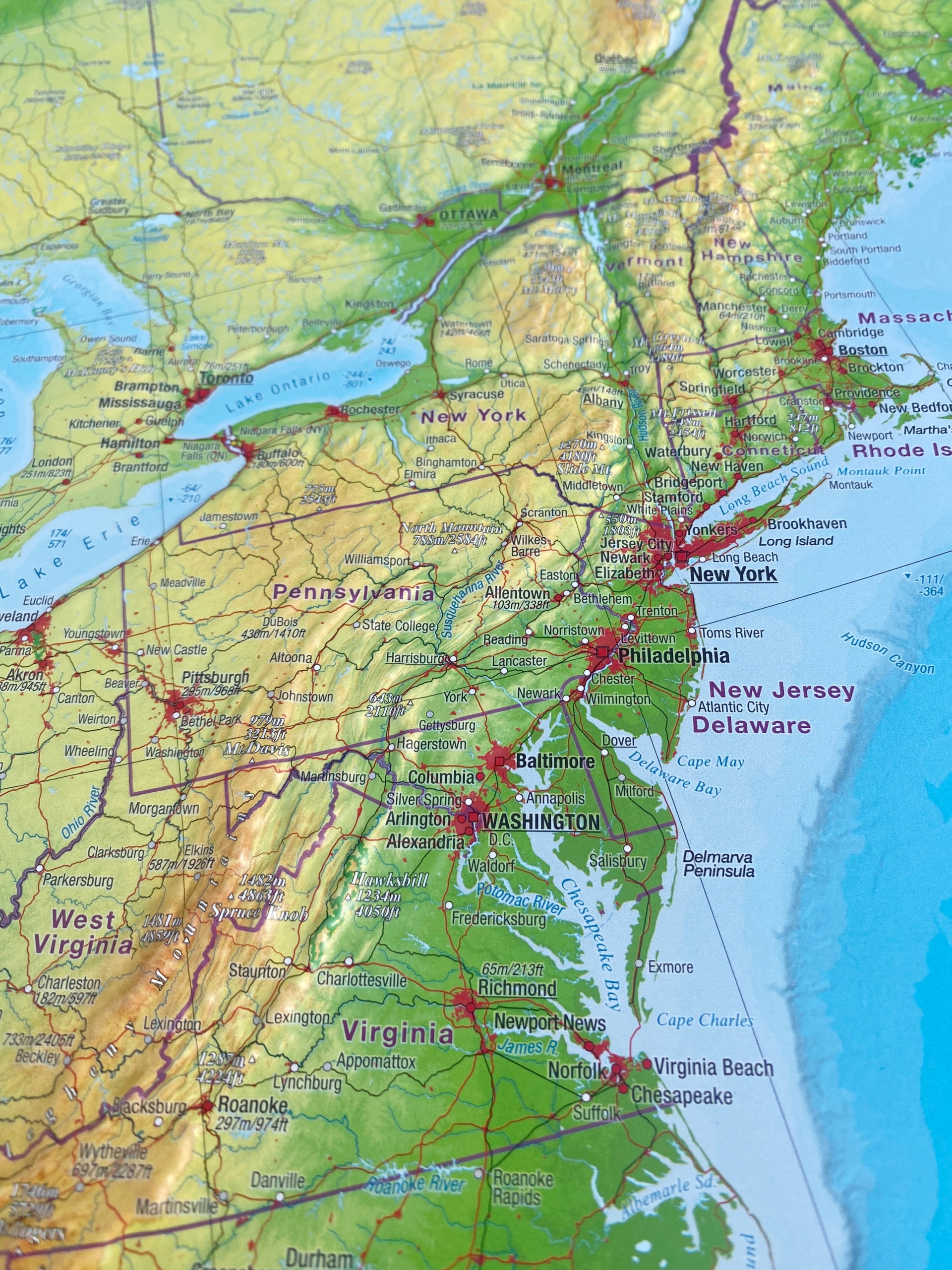
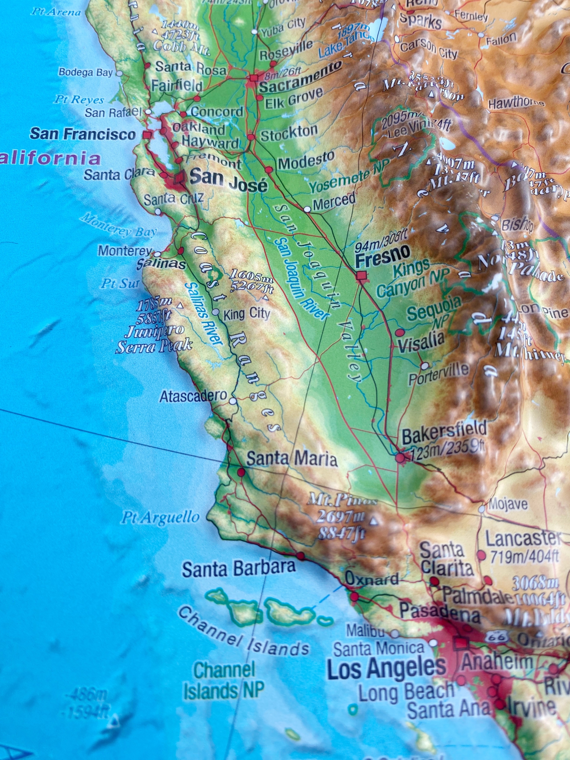
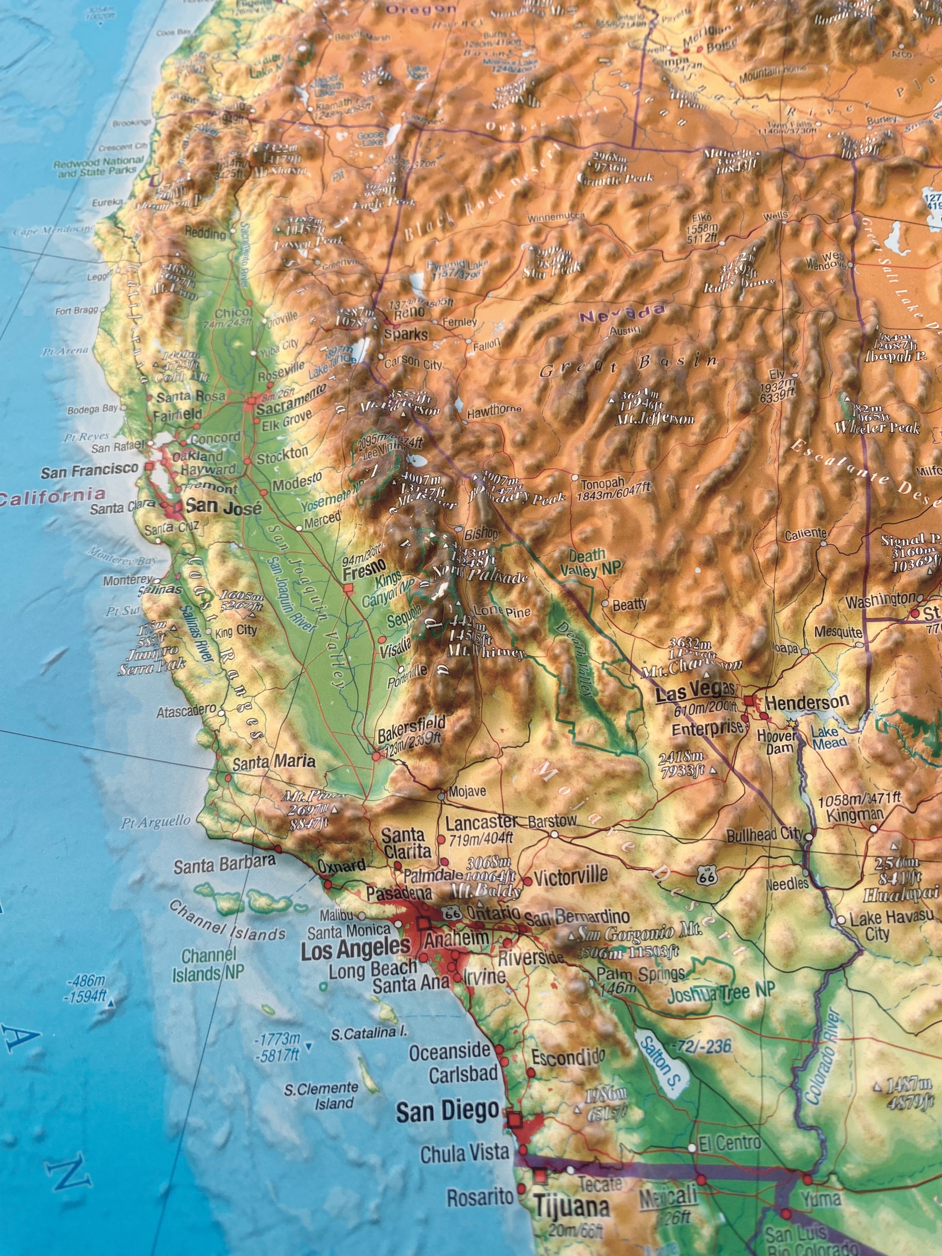
The map presents, in vivid detail, the relief of North America through the use of hypsometric tints, accurately depicting major mountain ranges, valleys and peaks, hydrographic features such as rivers and lakes, as well as distinctive geomorphological landforms.
This unique Map with a superelevation of 12, produced following avant-garde technology, gives a new dimension to cartography. Beyond its educational value, it constitutes a unique piece of art for every home and office and a special gift for any occasion.