


Description
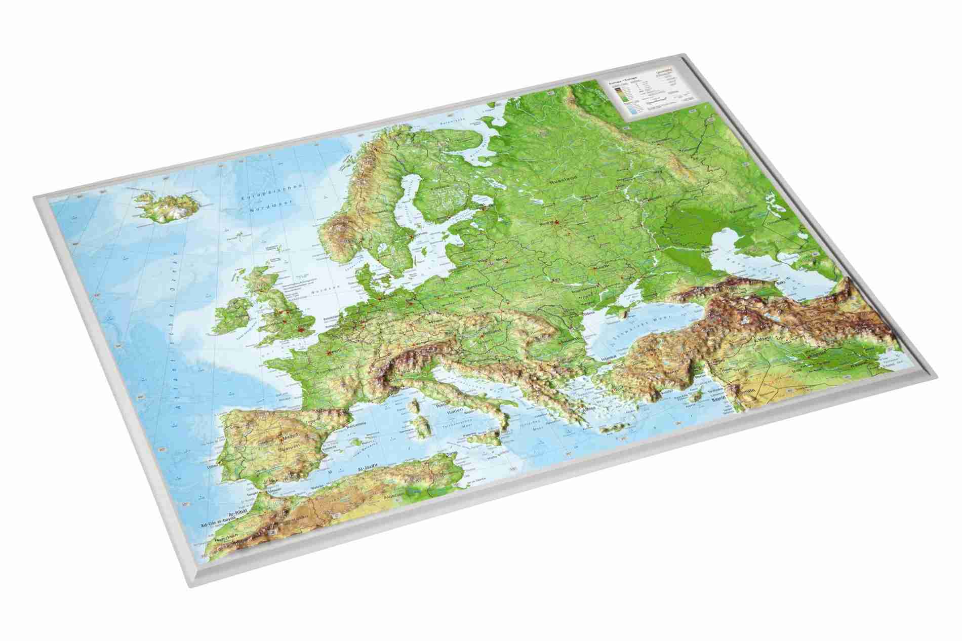
This unique 3D Relief Map of Europe and superelevation of 20-40, gives new dimensions to Cartography.
The colorful map depicts in detail the relief of Europe with the use of hypsometric tints showing in detail the plains, the mountain ranges, valleys and peaks, hydrographic features (rivers, lakes, dams etc.) and unique geomorphological landforms. The road network is classified in categories including motorway network, federal highways, and the main railway system.
All settlements and city names are in English.
The 3D Maps have been produced following the highest cartographic standards and avant-garde technology and give a new dimension to Cartography. Further to their educational value, they constitute a unique piece of art for every home and office and a special gift for any occasion.